Maine Helicopter Lighthouse Tours
There are probably two icons most people think of when Maine comes to mind. Lobsters and lighthouses. In either order. Lobsters are easy to get a good view of, and even get a good meal from. Maine lighthouses on the other hand can be a little harder to get but with Point of View Helicopter Services, you can even acquire a taste for these!
Nobody really knows when lights began their use as guides to mariners but for quite a while they were simply fires on hilltops or points that would mark the entrance to a port. Later, ancient Egyptians and Greeks began building towers, wooden and then stone, to more reliably mark where home was.
The modern age of lighthouses really began with the settlement of North America as transatlantic voyages became more frequent. As this trade developed, not only were ports marked but with the increase in accidents, navigation routes, ledges and reefs became recipient of lighting structures.
The first light be built in colonial America marked the entrance to Boston harbor in 1716. The oldest surviving light in the U.S. never rebuilt or fully destroyed, is the Sandy Hook light in NJ, built in 1764. Maine’s first light was at Portland Head and completed in 1790. Of course Maine was part of Massachusetts until 1820. Famed New England author Robert P. Tristram Coffin in 1937 published his classic book The Kennebec: Cradle of Americans in part because during 1607, one of America’s first colonies began at this river mouth. The Popham Colony at the Kennebec was England’s first attempt to settle New England, while the French preceded the English by a few years with a small colony on St. Croix Island in 1604.
Native Americans were in this area for the previous 15,000 years since the glaciers receded and the French were met by Passamaquoddy who called the St. Croix River Skutik. At the Kennebec, or Kennipik, the short-lived English immigrants were met by the Abenaki who helped them through a harsh winter, ultimately cause for the colony’s failure and return to England of survivors. Abenaki is a mis-translation and mispronunciation of Wôban-aki, Native American word for describing the land and people, meaning People of the Dawnland, the First Light, or simply of the East.
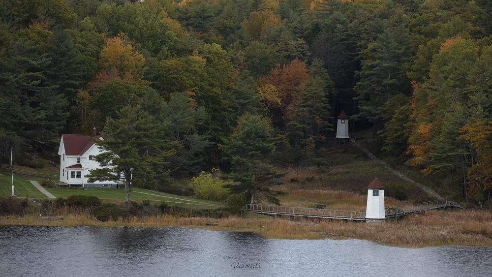
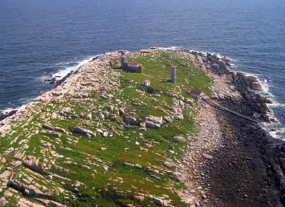
With early exploration and after a European respite until about 1620, it’s no surprise that the second light to be built in what is now Maine was on Seguin Island, 2.5 miles off the mouth of the Kennebec. While Georgetown residents petitioned the Massachusetts Court for a light in 1786, the first light tower was not commissioned by George Washington until 1795 and the current tower and quarters were built in 1857.
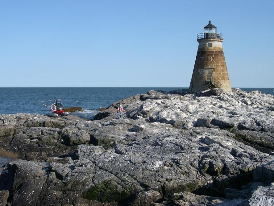
Point of View Helicopter Services is based in Bowdoinham about 19 miles up the Kennebec River from Seguin on Merrymeeting Bay. Between Seguin and here are the following lights: Pond Island, Perkins Island, Squirrel Point, Doubling Point Range Lights and Doubling Point. Due south from where we are hangared at the Auburn-Lewiston airport (KLEW) we often fly out to and land on Halfway Rock, a small ledge in the middle of outer Casco Bay between Portland Head and Small Point, just west of the Kennebec mouth. This amazing light, now restored and privately owned is currently featured on our home page.
Just a few of the other iconic Maine lights we have gone by or flown to on lighthouse tours, bird surveys or in the course of other work include: Saddleback Ledge, Matinicus Rock, Mt. Desert Rock, Ladies Delight (the only inland light east of the Mississippi), Franklin Light, Ram Island Ledge and Pemaquid Pt.
To learn more about Maine’s lighthouses, here are a few great references. We hope this blog and some further reading will whet your appetite for a close up lighthouse tour with us!
Maine Lighthouse Friends
Lighthouse Digest
American Lighthouse Foundation


Winter Flying
“Do you fly in the winter?”
This is a question we are often asked, and the answer is, absolutely!
There is of course the performance issue-colder air is denser which in laymen’s terms mean the rotors (or propellers on a fixed-wing aircraft) bite into the air more effectively. Density altitude is pressure altitude (your absolute elevation) adjusted for non-standard temperature. When conditions are standard, density and pressure altitude are the same. When temperatures rise above standard, density altitude rises so this is the equivalent of flying at a higher altitude in less dense air where engine power, lift, take off distance and thus performance, suffer. In winter, when temperatures are routinely below standard, the opposites are true and as a result, performance is improved.
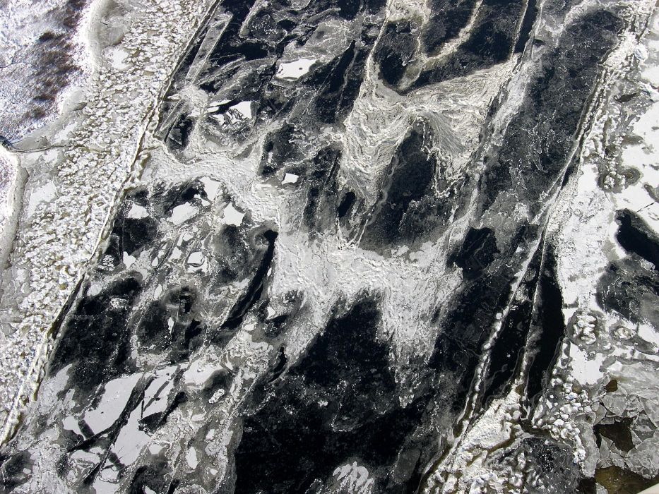
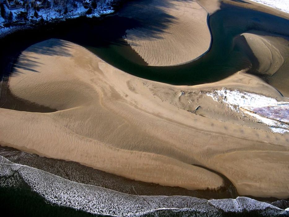
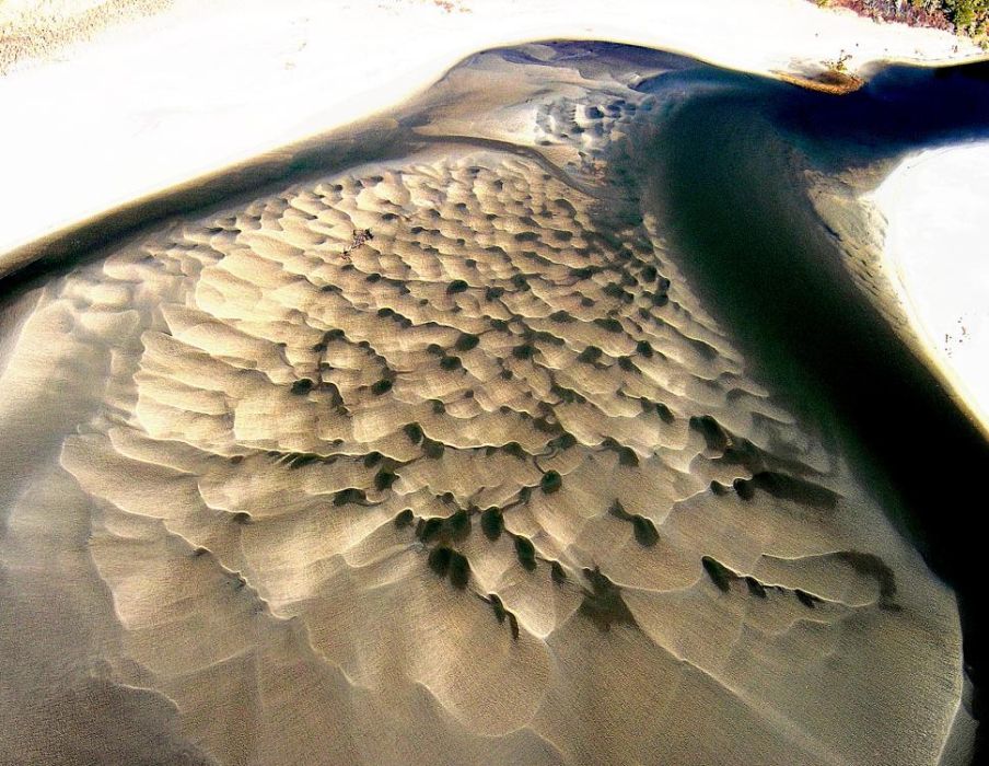
Performance issues aside, the Maine winter landscape is different and while lacking in the color spectrum found in summer and fall has its own remarkable textures, patterns, unique physical features and wildlife. Depending on where we fly, a wide array of unexpected variations in snow and ice may be seen- glassy lakes, fine cracks, ice bergs, pan ice, coatings of salt ice, featureless snow or wind drifts, open ice holes with or without steam rising, ice bumps, radiating cracks, zebra cracks, melting surfaces. There can also be mud bergs, unobstructed views through bare-leaved hardwoods and winter smelt camp colonies.
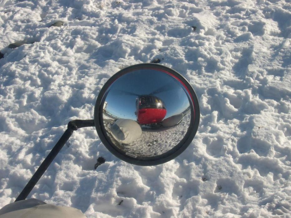
“But isn’t it too cold?” Nope. Remember we are sitting in an acrylic “goldfish bowl” and we do have heater but, as long as we are flying with the sun in front or to the side of us, our goldfish bowl becomes a flying greenhouse and temperatures are usually quite comfortable. The winter sun angle is lower making for more dramatic photography conditions. So, whether or not you’ve got a bit of “cabin fever”, don’t let winter ground you!


Upgrading State Water Quality Classification on the Lower Androscoggin River
Upgrading the Upper Lower Androscoggin
After many years of water quality data gathering and reclassification attempts, Friends of Merrymeeting Bay (FOMB) data were used to successfully upgrade state classification of the lower Androscoggin River from Worumbo dam in Lisbon Falls to Merrymeeting Bay. The river section had been classified as Class C for many years, the state’s lowest category while the actual water quality as measured by dissolved oxygen (DO), E. coli bacteria and aquatic life was that of Class B, with significantly higher standards. State and federal laws prohibit backsliding of water quality but this is measured by classification so having actual conditions surpass those of the classification means there is room to pollute and still meet the current and lower classification.
There is a great deal of interest in extending the upgrade up river but data from this section between Worumbo and Gulf Island Pond (GIP) are somewhat sporadic. There is a small amount of historic data from FOMB, more recent aquatic life data from FOMB (used in the earlier upgrade effort), some Brookfield and some DEP data, largely focused on the Lewiston area. In the most recent DEP nomination request for upgrades, Grow L+A submitted a proposal to bring this “upper lower” section from Class C to Class B. The DEP does not support this.
Because most FOMB water quality volunteers live lower on the river and closer to the Bay, last year we looked at the possibility of using a helicopter with amphibious floats as a means to gather comprehensive data in support of the upgrade with limited personnel. We did a trial flight in 2024 and were very successful at sampling a longitudinal profile of 10 sites from Lisbon Falls into GIP with two people in about 1 ½ hours.
In light of this, the Merrymeeting Bay Chapter of Trout Unlimited (MMBTU) and FOMB split the cost of six flights this year, one in June (6/26), two each in July (7/18 & 7/29) and August (8/12 & 8/22) and one in September on 9/5 (our focus is on hot and dry “worst case” low flow conditions) in an effort to provide the most comprehensive data to-date on this section to back up the upgrade proposal if data warranted it. We had exceptionally low flows for the final two flights and low on the previous two flights as well. USGS Auburn river flows on 8/22 were 1,280 cfs vs the 96 year median of 2,872 cfs and on 9/5 1,300 vs 2,940 median.
Our results for 2025 have been outstanding with all stations easily meeting Class B standards which for DO are a minimum geometric mean of 7 parts per million (ppm) and E. coli not to exceed a geometric mean of 64 colonies/100 ml over a 90 day period. Of 198 total measurements for DO in mg/l, DO in percent saturation and E. coli bacteria, every individual DO and E. coli reading except A8 [Deer Rips impoundment on 9/5 at 6.7ppm] has met Class B standards of above 7ppm for dissolved oxygen and bacteria (99.995% compliance and Deer Rips falls under the hydropower exclusion). Because current DO standards for Class B are 7 ppm or 75% saturation, whichever is higher, and since the DO % at A8 on 9/5 was 76.6%, all individual sites meet the Class B standard for dissolved oxygen at each sampling event. See charts17-20 below.
Total geometric mean results by station from Lisbon Falls to GIP are (DO/E. coli bacteria):
8.4/19.9, 7.8/20, 8.1/29.5, 7.7/44.6, 7.7/35.1, 7.9/31.6, 7.6/15.7, 7.6/12.4, 7.3/9.1, 8.0/3.6. Geomean totals are: 7.8 for DO and 18.1 for E. coli.
E. coli levels rise as we move upstream closer to the L/A wastewater plant mixing zone influence and then diminish upstream of it. Class C minimum for DO is 5ppm and maximum geomean for bacteria is 100 colonies/100ml.
FOMB rented a pH meter for last flight to get a sense of acidity readings and they were all within the acceptable range of what DEP would like to add to standards.
The Board of Environmental Protection held a public hearing October 16 on all classification proposals and some other proposed changes to statutory language. Grow L+A, FOMB, Trout Unlimited and the Natural Resources of Maine all testified in favor of upgrading this river section from C to B. The FOMB testimony and report details are a result of sampling from helicopter for 10 sites on six dates. In depth legal testimony was provided by attorney Scott Sells. The Board will hold their deliberations at a future date.
Our Point of View Helicopters Schweizer 300C on amphibious floats is the perfect tool for this type of work which could not have been accomplished any other way particularly since DO measurements must all be completed by 8am and our work covered 20 river miles with limited access points and multiple impoundments. In our Video section, please see a couple of short clips-one with music (thanks to IDEXX) and one without, filmed by Aquaterra Films, of landing and sampling at Site A3 in Durham on 8/12/25.


There is Free Lunch!
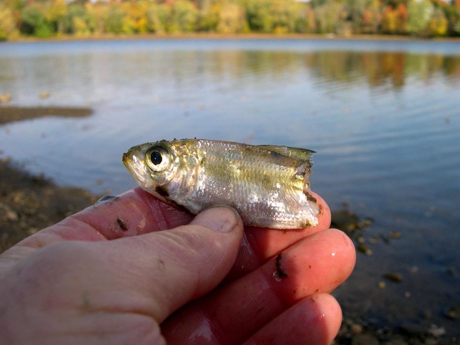
Alewives and blueback herring are anadromous fish species spending most of their 4-7 year lives in the ocean and coming up into freshwater ponds, lakes and rivers to spawn. Collectively these river herring occupy a space in the lower middle part of the food chain and because of their ecosystem importance are considered a true keystone species. Pull the river herring out and the food chain arch collapses. Why are they so important? Not just because they are the favorite bait for lobstermen but because so many birds, fish, mammals and reptiles eat them.
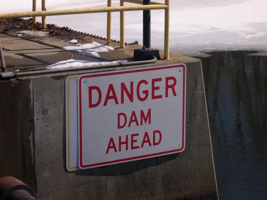
River herring school in the thousands. They get to be about 7-8” long and typically head into the rivers in mid-May-mid-June. Like other migratory fish species in Maine such as striped bass, rainbow smelt, American shad, Atlantic and shortnose sturgeon, Atlantic salmon, tomcod, sea lamprey and American eel; if a dam or even a natural obstacle blocks their way, they are screwed. Various dams now generally have artificial fish passage, typically a ladder of sorts running from pool to pool or sometimes a fish lift or elevator, providing a way for the fish to reach the height of the dam, swim into the headpond and onward. Onwards and upwards. Artificial passage requires lots of tinkering and is a poor substitute for dam removal.
Alewives favor slow moving and typically shallow ponds for spawning while bluebacks, coming a bit later in the run, favor moving water of streams for spawning. These fish are repeat spawners, becoming sexually mature at 3-4 years and spawning for several years. After spawning, the adults leave the rivers and then later in the fall, the juveniles or young-of-the year (YOY) will out-migrate in large groups. Out migration poses a huge hazard to all migratory fish, again because of hydropower dams.
All dam turbines are protected from flotsam and jetsam by coarsely spaced bars-like a jail cell, and called trash racks. The problem is that historically trash rack spacing is wide enough to allow fish through and into the turbines. Turbine mortality is a huge problem. Imagine four dams on a river and that herring have passed upstream either through passage at each dam (they are really tired by the end) or trapped and trucked by the Department of Marine Resources (DMR). 50% turbine mortality is a realistic number. Start with 100 fish above the uppermost dam and after downstream passage there are 50 left. After dam #2 there are 25 remaining, after dam #3 there are 13 fish and after the fourth dam there are only 6 or 7 adult fish able to make it out to the ocean. The devastating power of compounded interest! There is nothing green about this kind of energy production.
In 1998, Edwards dam at head of tide on the Kennebec River in Augusta was removed, the first working hydro dam in the country to be dismantled. It was producing one tenth of one percent of Maine power and blocking 17 miles of prime spawning habitat up to Ticonic Falls in Waterville/Winslow and beyond. The Sebasticook River comes into the Kennebec from the east in Winslow below the Kennebec falls. For years, Fort Halifax dam stood a few hundred yards upstream of the Kennebec mouth blocking fish passage to prime river herring spawning habitat and creating a large impoundment.
After realizing the installation of fish passage at Ft. Halifax would be too costly, the decision was made to remove the dam and this finally happened in 2008 after among other things, a lawsuit by residents living on the impoundment not wanting to lose their lake, was brought and lost. With removal, the lower Sebasticook was reborn and river herring quickly returned.
The next dam, upstream about 7 miles, is Benton Falls which was a notorious fish-killer during downstream (attempted) passage. Under quite a bit of bad publicity from activists in the watershed including Friends of Merrymeeting Bay and Kennebec Reborn, Benton owners cleaned up their act, installing a fish lift, closely spaced racks above the turbines that can be lowered into place during migrations and a bypass area for out-migrating fish to use instead of the turbine passage.
Long story short, the Sebasticook has become a poster child for river herring recovery in the state of Maine. In 2025 a previous record was smashed by about 3 million with over 9 million river herring passed over Benton Falls. With a mass of fish this large, it is like Cookie ringing the chuck wagon bell on a cattle drive from the Tex-Mex border to Abilene; every hungry cowpoke descends on the chuck wagon no matter where they were, to scarf up the grub.
At Benton, as fish stack up downstream of the fish lift, even when the lift is cycling continuously, all the critters come. Seals chase the herring 70 miles up from the ocean at Popham Beach, striped bass look for their meals as do snapping turtles, mink, raccoons, bears, otters and of course great blue herons, osprey and eagles. Word gets out on the bush telegraph and now it is common to see hundreds of bald eagles in the area. Each spring Point of View Helicopters flies a couple of flush counts on the lower Sebasticook, to Benton and then another 12 miles to the Burnham dam. A flush count is an aerial census method done at treetop level and we count eagles flushed or remaining perched in the trees as we go by. Using a clicker counter in each hand, one for juveniles and one for adults, our observer gets so darn busy he or she must get treated for hand burns (just kidding)! On our June 4 flush count in 2025 we counted about 340 eagles from the Sebasticook mouth to Burnham. This is a remarkable Endangered Species Act success story.
Springtime is when most wild critters have and raise their young. All of Maine waters have fish consumption advisories on them for mercury and a subset (including the Sebasticook and Kennebec) have much more restrictive advisories for such toxins as dioxins, PCB’s and PFAS chemicals. Fish that live here year-round are not healthy to eat so, the wonderful thing about these massive river herring runs is that these are good clean ocean sources of protein just at the right time to fortify wildlife parents and their young. Given access to spawning habitat, river herring provide the perfect meals at the perfect time.
Sometimes there is a free lunch!


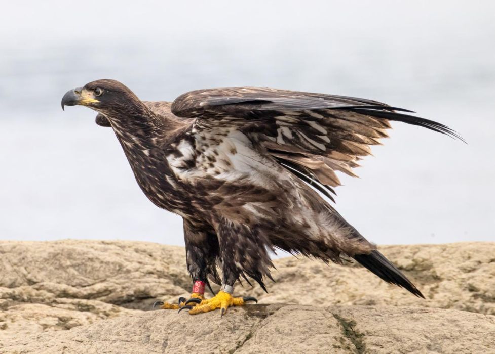
Bald Eagle Surveys
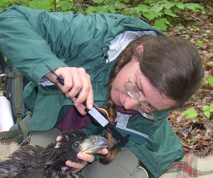
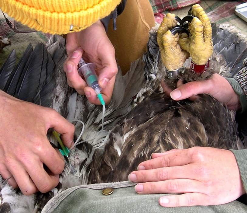
Each spring Point of View Helicopter Services partners with Friends of Merrymeeting Bay (FOMB) and Biodiversity Research Institute (BRI) to band eaglets in the Merrymeeting Bay area and gather feather and blood samples from them for contaminant analyses. The Merrymeeting Bay eagles are a subset of a larger area we fly that includes about 80 current and former nest sites with typically about 50 being active for all or part of the breeding season.
Our route begins in Auburn and takes us up the Androscoggin River to Gulf Island Pond where we head east over to Sabattus Pond then over to Pleasant Pond in Litchfield, back up the Cobbosseecontee Stream to Cobbosseecontee Lake, over to Anabessicook and Conchiwagon Lakes , back via a large heronry to Cobbosseecontee Lake and then to Hallowell on the Kennebec.
From Hallowell it’s down the Kennebec River to Merrymeeting Bay and then over to Wiscasset to refuel. From Wiscasset we head west over the New Meadows River and then continue back to the lower Androscoggin in Brunswick and Topsham. From here we follow the Androscoggin back to Auburn.
Flying surveys lets us keep track of bird health and populations but is also important for hands on work with chicks later in the spring. Usually there is a first flight in February just to see if anyone is around or a particularly early nester. We flying more frequently in March - May to note when adult birds start nesting, when chicks hatched and how many there were. These data are important when scheduling and carrying out sampling because there is a prime time for handling and sampling birds of 5-7 weeks old-after they feather out, but before they are too big and start becoming adept with their wings.
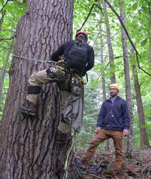
The process of actually sampling nests is done with a biologist climbing the nest tree, wrangling a chick into a cloth bag and lowering it to the ground where a couple of crew members can work it up with their sampling and banding. When done, the bird goes back in the bag and the climber who has stayed by the nest, hauls it back up and releases it into the nest. If there are multiple chicks, the process is repeated until done and the climber can descend.
Eaglets weather the process quite well and are generally quite calm throughout. Sometimes adults may call a bit but generally after a few minutes everyone settles down. Adults have a long period of time and lots of energy invested in the reproduction and chick-raising process until fledging so they are not scared off easily. With probably over 1,000 such bird samplings BRI has never had an incident where a chick has been harmed or the adults did not return and go about their business normally.
Sometimes, storm damage can take a toll on nests and avian influenza continues to impact eagles population-wide, as do lead bullet shards in coyotes or other hunter prey left behind and scavenged. Tune in next month to learn about where eagles go for a huge “free lunch” in May and June.
Ed Friedman